
- Distance – 9.35 miles / 15.05 kilometers
- Elevation Gain – 1627 feet / 496 meters
- Elevation Loss – 1614 feet / 492 meters
- Average Temperature – 86° F / 30° C
- Total Mileage – 94.98 miles / 152.83 kilometers
We were finally able to get back on the trail this past Sunday. Knowing the passage is reported as being 21.5 miles / 31.6 kilometers, we decided to break it into more manageable sections. Luckily on this passage, we are able to get on and off the AZT at different trailheads along the Catalina Highway playing leap-frog with our vehicles. We planned to hike from the end of the passage downhill to the beginning. Summertime in the desert is too hot to safely hike unless it is done in the early morning or dusk hours. Neither of us wished to be on any trail on the mountain during those hours because of the wildlife, so we decided to begin at the highest elevation where the temperatures are much cooler.
Our planned hike was from the Control Road on top of Mt. Lemmon to the intersection of the Butterfly Trail. At the Butterfly Trail we would walk the 1.4 miles / 2.25 kilometers to the trailhead where my vehicle was parked and waiting for us. Looking at the trail profile, we figured the hike to the Butterfly Trail would be mostly downhill. (Remember we are hiking from the end to the beginning or right to left on the profile.) We parked Lova’s truck at the end of the Passage and began walking down the Control Road to the Crystal Spring Trailhead; a 3 mile / 4.83 kilometer hike. The vistas were fabulous all along the way.
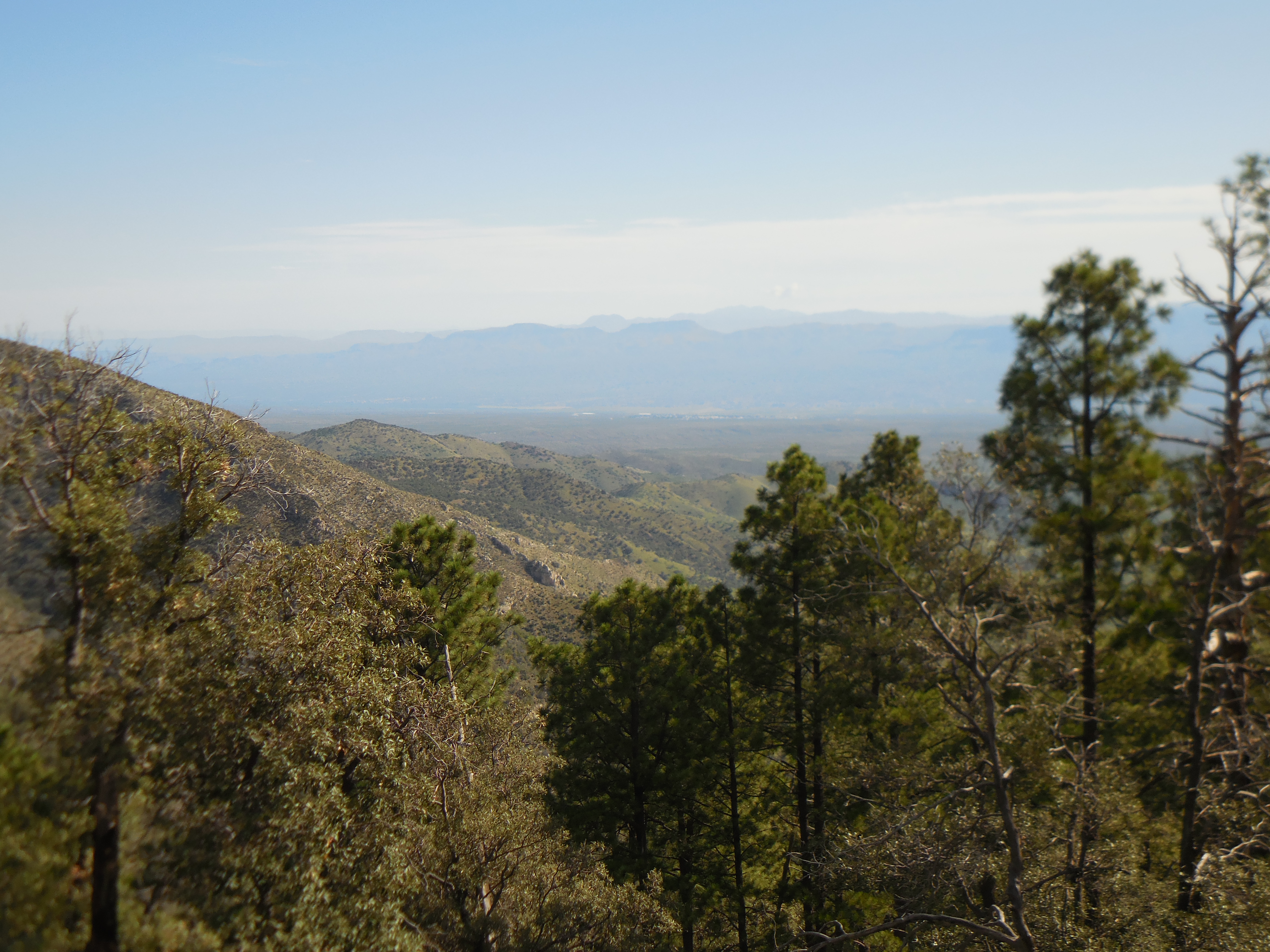 At the Crystal Spring Trailhead we attempted taking our usual AZT Selfie, but could not capture the little trail marker and us in a single shot (arms simply were not long enough; neither one of us has one of those annoying Selfie Sticks).
 We hiked, no, let me correct that, we climbed the Crystal Spring Trail. What we thought would be downhill was turning into a slow slog uphill. It appears both Lova and I should attend a class on Profile Reading.
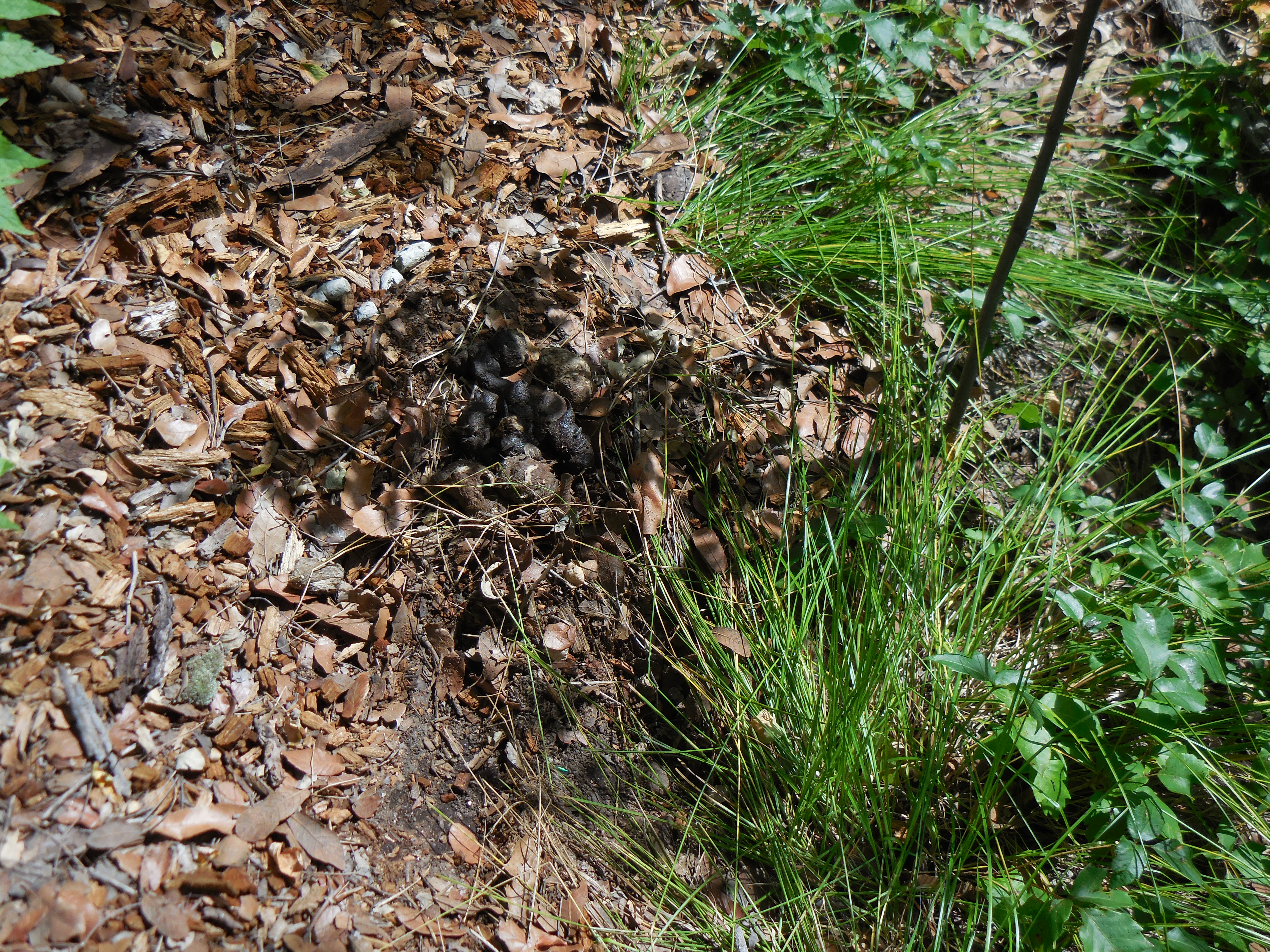
At about mile 3.5 into the Passage pretty close to the beginning of the trail, we passed some fresh (but thankfully not steaming) bear scat right on the trail. I pointed it out to Lova.
I wear a whistle around my neck while hiking and so asked along with making ourselves look big should we encounter a bear, were we supposed to make noise or remain quiet. Neither of us knew what we should do – but now we do. I have also ordered a can of bear spray to carry with me on future hikes in the mountains as well. http://www.mountainnature.com/wildlife/bears/bearencounters.htm
After the scat sighting, we continued to climb and at about mile 5 when we thought we were approaching the Butterfly Trail intersection we came upon two young hikers going in the opposite direction. They looked fresh as though they had just begun hiking. We asked how far the Butterfly trailhead was and they told us about 3 miles to the turnoff for the trail and then another 1.5 to the trailhead.
Not possible we both thought, my Garmin fenix3 reported we had already hiked 5 miles. By this time I was dragging, the day was getting quite warm and my legs were beginning to feel the lactic acid buildup. We managed to get ourselves off trail and began bushwhacking through a section of burned out felled trees. Both of us got our legs all cut up in this section.
Even though the fenix3 navigation did not show us off course, we knew something was wrong, we could not see the trail anywhere. So we headed back to where we came from and there it was as clear as could be – a very defined trail! We were never far off the trail which is why the navigation didn’t show us off course.
The only explanation for missing the trail was in parts it was obscured by much overgrowth. Possibly upon entering the area of burnt felled trees we were not paying attention to the trail.
Well, we made it to the Butterfly Trailhead finally, stripped off our packs and gave each other a high-five! I was exhausted, my legs felt like someone had tied concrete blocks to them and I was dripping wet from perspiration. 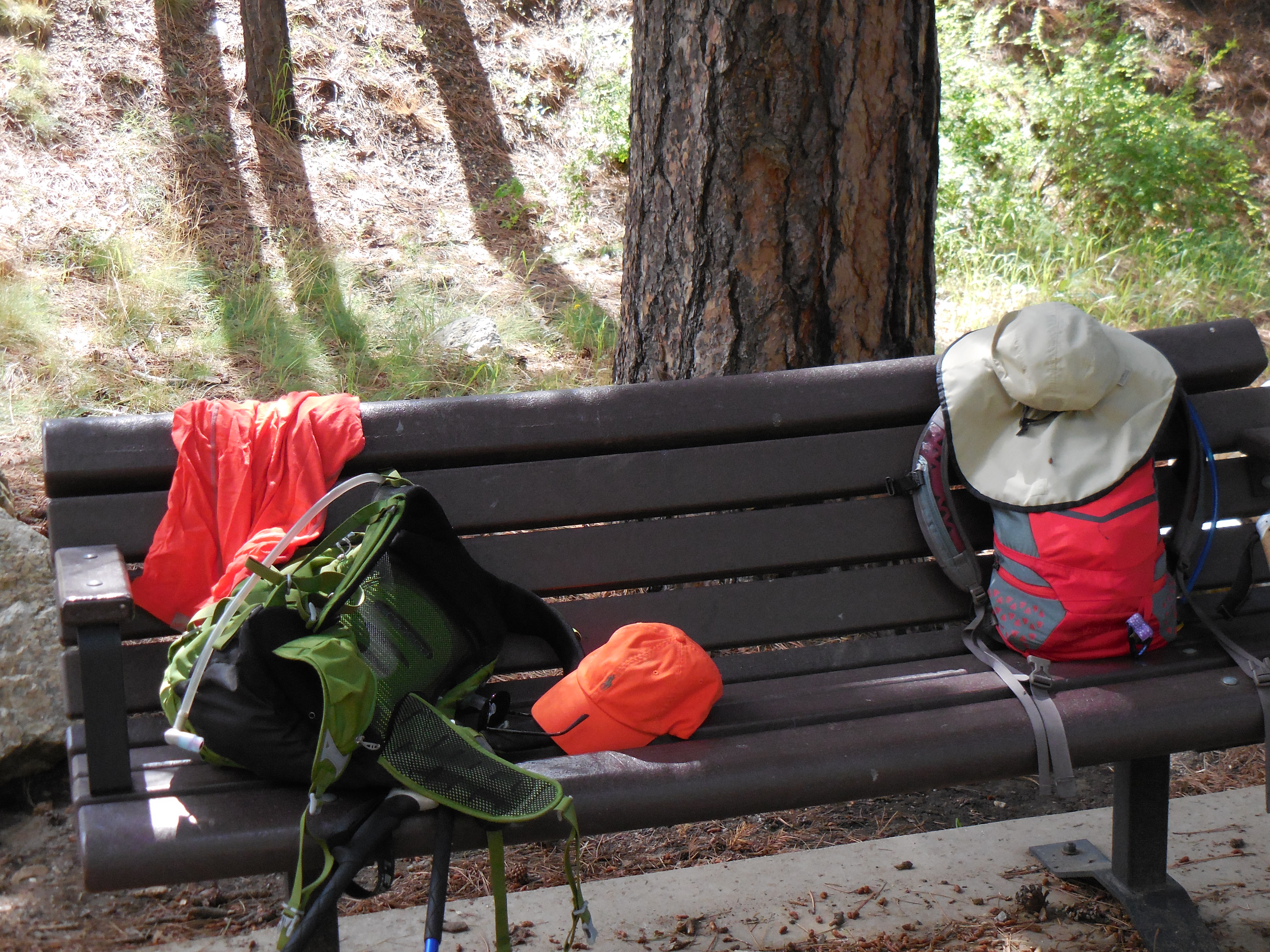
I was very happy to change my shirt and to finally be able to sit down at the Saw Mill Run (on their patio) back on the top of the mountain in Summerhaven for a nice cold Dark and Stormy along with a grilled vegetable wrap. Lova had an IPA with her grilled vegetable wrap.
According to the official Green Trails Map of the Santa Catalina Mountains, our total hike should have been 6.6 miles – as you can see from the stats listed at the top of the blog, the actual hike was approximately 50% longer!
