

- Distance – out and back – 5.93 miles / 9.54 kilometers
- Elevation Gain – 814 feet / 248.11 meters
- Elevation Loss – 784 feet / 238.96 meters
- Average Temperature – 93.1° F / 33.94° C
- Total Mileage – 5.93 miles /9.54 kilometers
Several years ago, I walked a portion of the trail in Vail, Arizona after having had my son recommend it as a great hiking trail for me. That little day hike was enough to get me excited about attempting the entire trail. My only problem was I didn’t know anybody who would take on an adventure like that, backpacking and sleeping out in the wilderness.
I ordered a guidebook and read it from cover to cover. I became even more intrigued by the trail. I talked it up to a few friends, but nobody was interested. I never gave up on the idea of hiking it, gosh I would do it on my own if I had to, but for the meantime it was put to the back of mind but definitely high up on the bucket list.
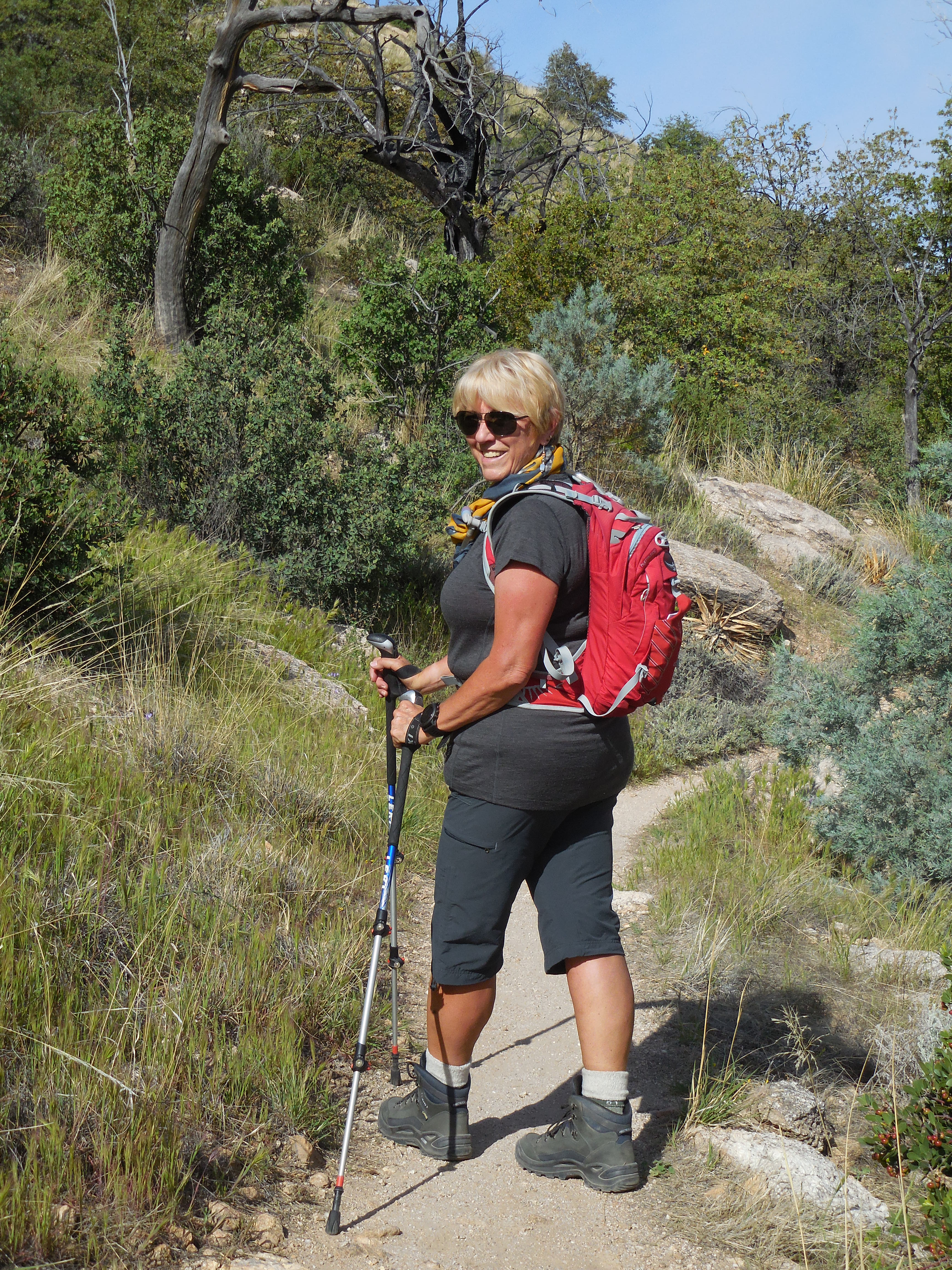
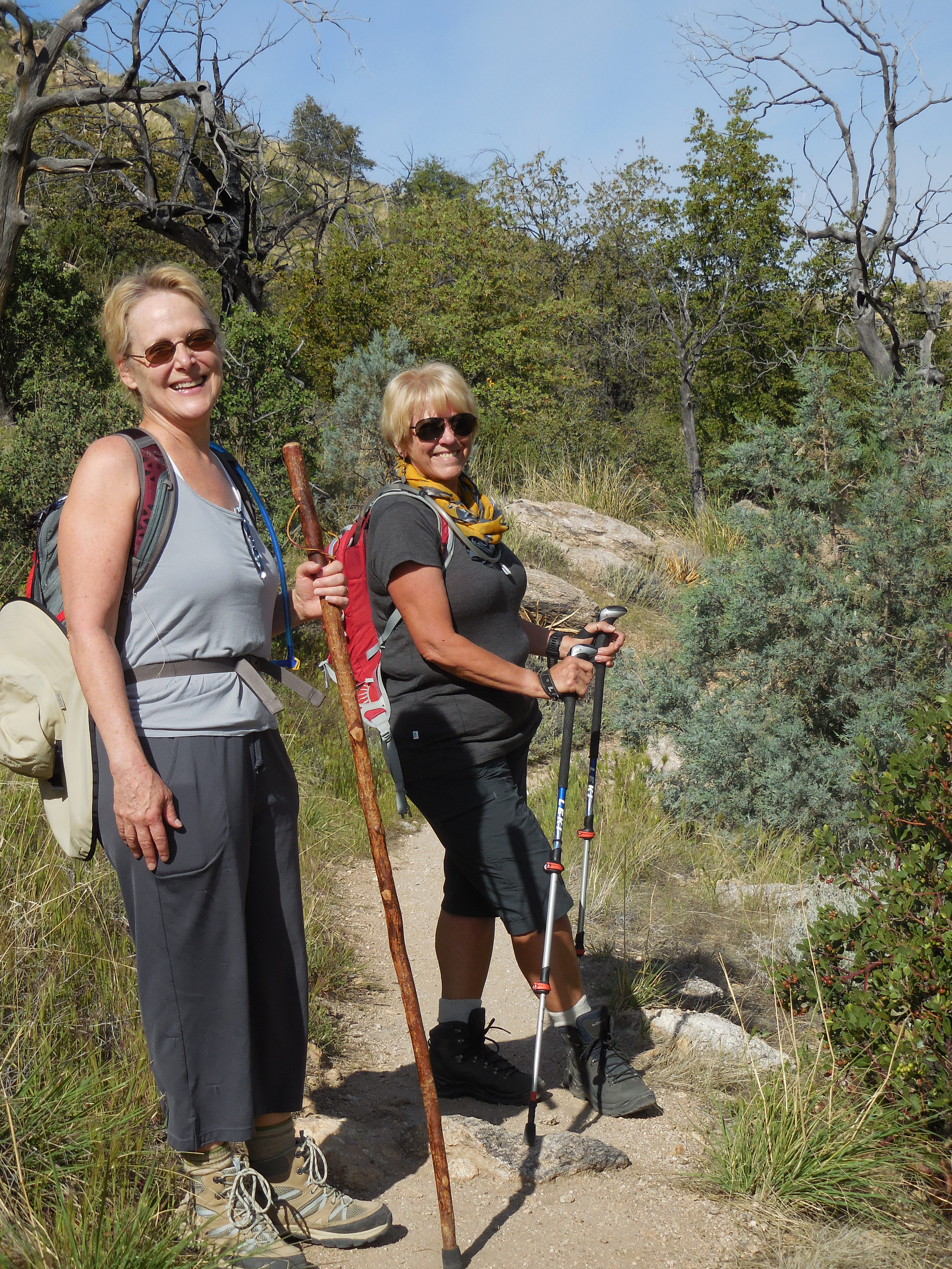
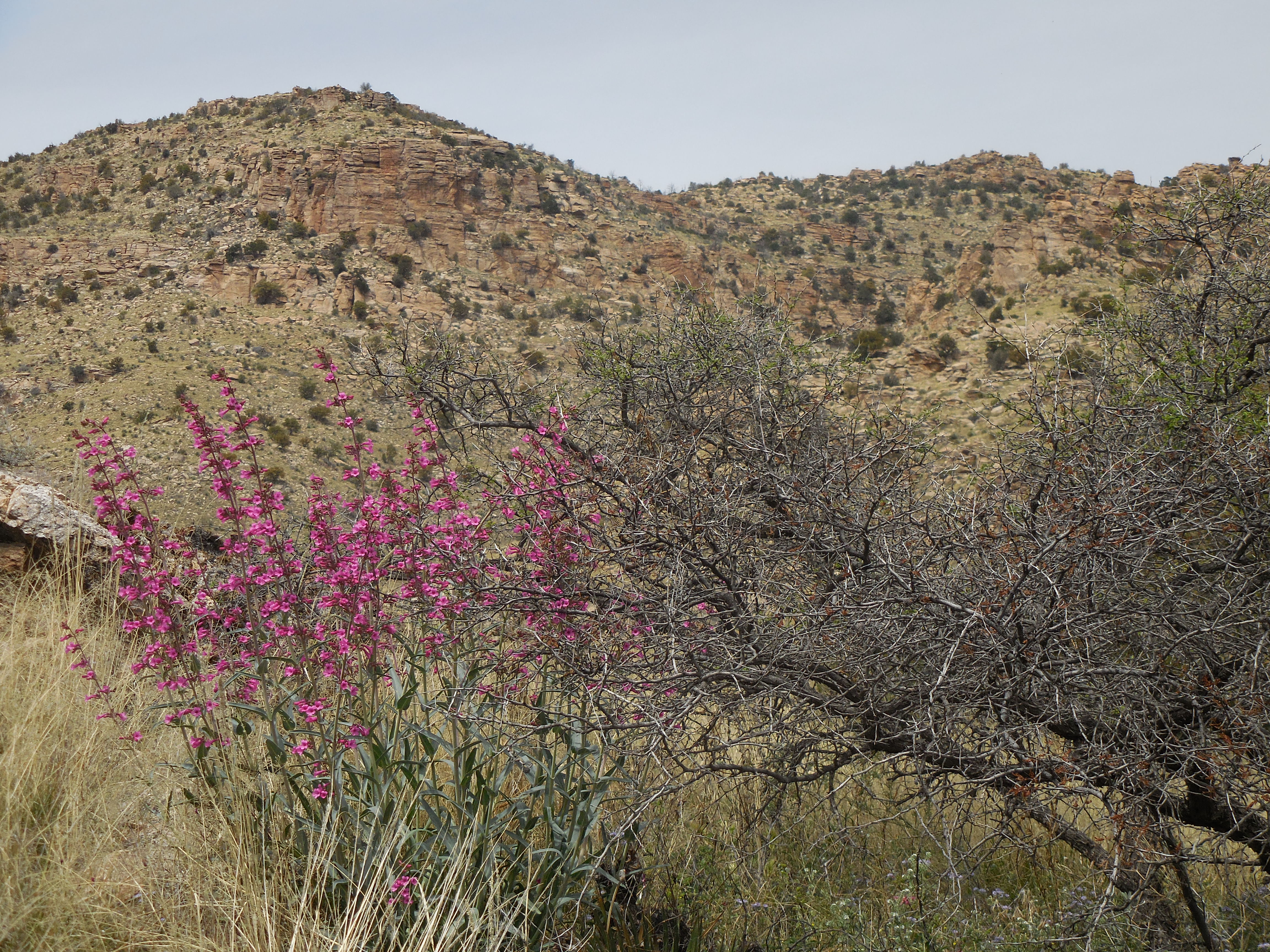
- Currently we, Lova, Sue and I, are hiking portions of the AZT each Sunday. We have begun right here in Tucson up on Mt. Lemmon. Our first hike was on the Molino Basin Trail, we walked from the trailhead on Catalina Highway to the Prison Camp and then back to the trailhead.
That section of the trail was beautiful and at our turn-around point we got to view the remains of the WWII Prison Camp. The name Prison camp came from the Federal Honor Camp begun in 1937 to house federal prisoners supplying labor to build a road providing access into the Santa Catalina Mountains. Prisoners had been convicted of federal crimes ranging from immigration law violations to tax evasion to bank robbery.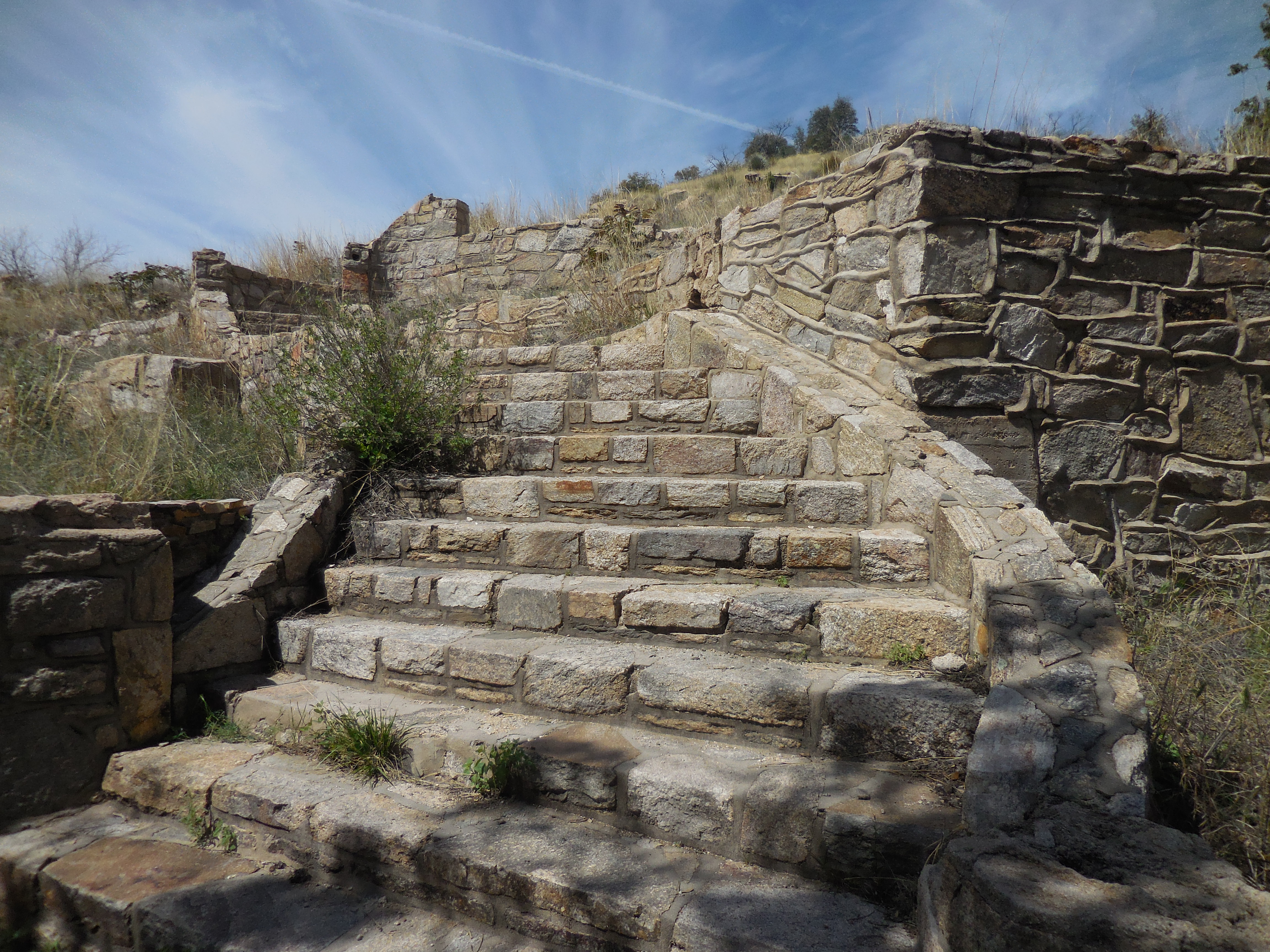
During World War II, many of the prisoners were conscientious objectors whose religions prohibited them from serving in the military. Some were Japanese Americans protesting the “Japanese American Relocation,” the largest forced removal and incarceration in U.S. History. After the Japanese Navy attacked Pearl Harbor in 1941, over 100,000 Japanese Americans, many American Citizens, were imprisoned in crowded internment camps for fear they would conduct espionage and sabotage along the west coast.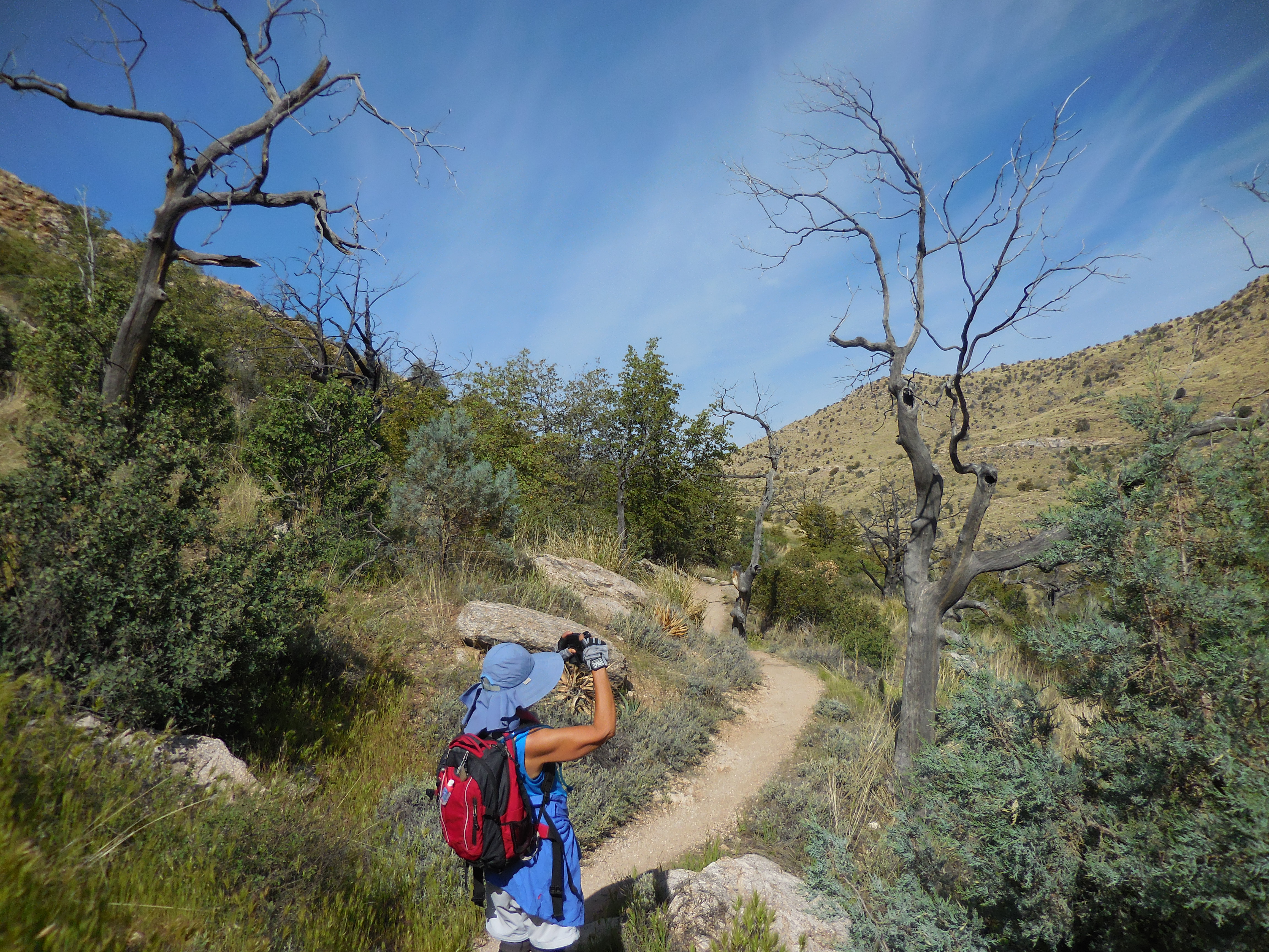

After we returned to the trailhead, we decided to walk the next section of the AZT the following Sunday. We would hike from the Gordon Hirabayashi trailhead on an out and back as far as we could get.
I was blissed, this is fulfilling part of my desire to hike the entire AZT – hey, maybe I can talk my hiking buddies into walking the entire trail with me.


Dear Arlene, WOW that sounds like an amazing project and how lucky are you to be living close enough to go out on successive weekends. Can’t wait to see the next installment 🙂 Britta
LikeLike
Hi Britta,
We are only going to be able to do successive weekends for a while, once we get more north in the State, we will have to do a week or so at a time. And unfortunately here in southern Arizona it gets awfully hot during June, July, August, September and some of November so doing hikes near where I live might become fairly impossible within the next 3 weeks or so – but then I will be off to Portugal and the Camino Portugués.
In September, I have plans to walk the South West Coast Path in England and in October, I will be hiking with my friend Lova in the Grand Canyon. So probably November on will be the AZT for the southern parts we missed this year. I’m psyched, it is a fabulous trail.
Just a bit of background – The AZT is one of 11 National Scenic Trails in our country and it was the third to be completed. In total it is 800 + miles long spanning from Mexico to Utah winding its way through the Grand Canyon and other National Parks.
Arlène
LikeLike