
- Distance – 14.95 miles / 24.059 kilometers
- Elevation Gain – 640 feet / 195.07 meters
- Elevation Loss – 725 feet / 220.98 meters
- Average Temperature – 86.8° F / 30.444° C
- Total Mileage – 66.05 miles / 106.284 kilometers
Our hike on Passage 7 was intended to be completed in one day. But the Universe had different plans for us.
We met early and drove to the end of our hike, the Gabe Zimmerman trailhead. I parked my car, grabbed my gear (checking to be sure I had my car keys :-)) and jumped into Lova’s truck. We then drove to the beginning trailhead, or so we thought.
We followed the directions in the official ‘Arizona National Scenic Route Guidebook’. At exactly the place, to the tenth of a mile, the guidebook said the trailhead would be, there it was complete with the description of the gate and all. We parked the truck, geared up and began walking the rough, steep dirt road the six tenths of a mile the book told us, looking for the Carsonite sign showing us the AZT.
When the road forked it seemed logical for us to walk to the right, we walked to the end of that road which took us back to State Highway 83. We then backtracked and at the fork walked to the left.
The AZT sent us a trail angel on a golf cart to put us on the proper trail. We waved our arms and called out to him – he saw us and drove his cart down the road to us.
When we told him we were looking for the AZT trailhead, he told us we were really lost. The AZT trailhead was back north on State Highway 83 about one half mile. We walked back to Lova’s truck, reread the directions in the guidebook; yes we had followed them to a tee, obviously this was a mistake in the book. We had hiked 3 miles already and were not even at the trailhead. I made a note to myself to notify the Trail Steward of this discrepancy in the guidebook.
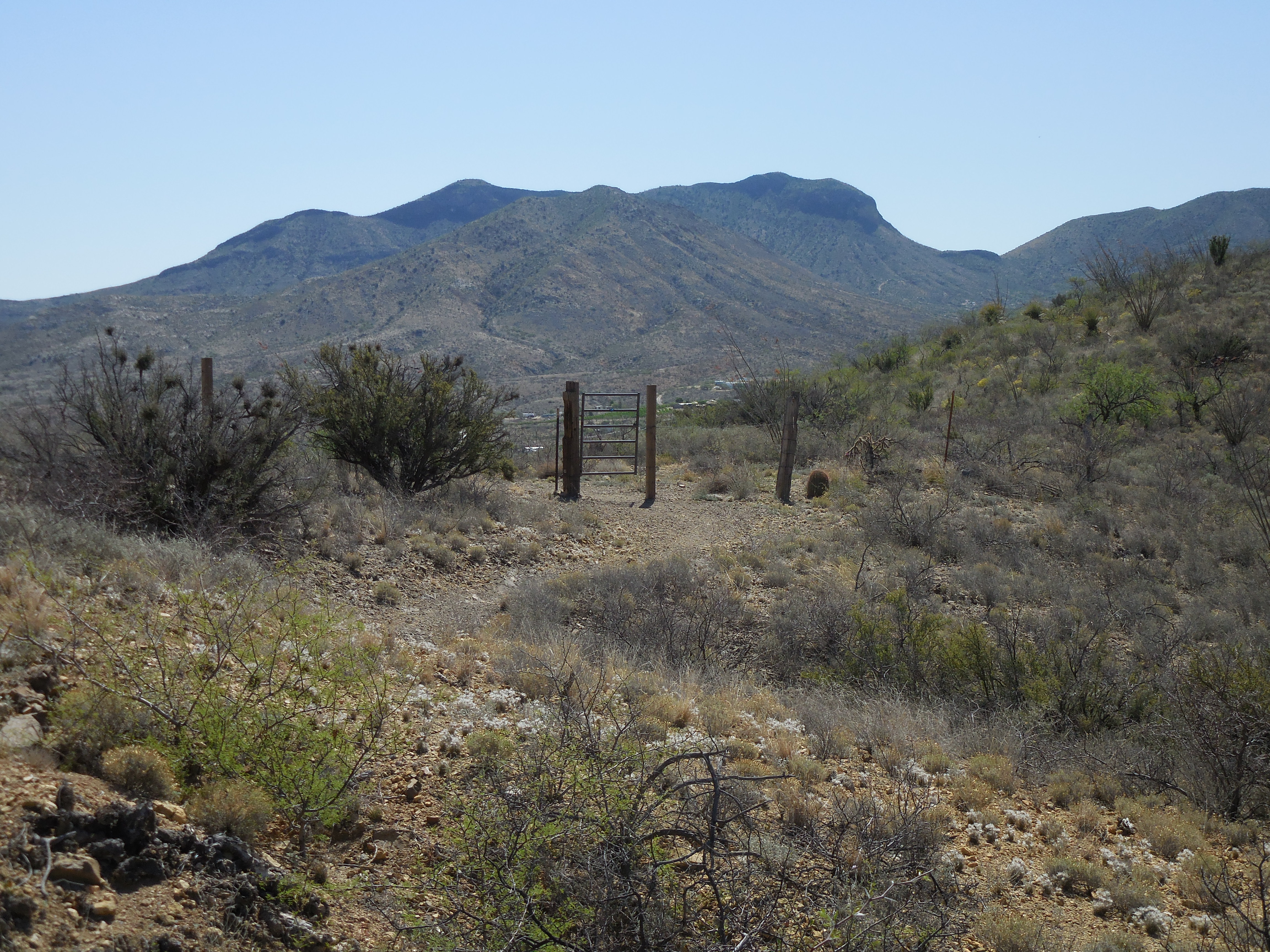
We got to the turn off from the Highway, parked the truck, walked through the gate and began walking up the deeply rutted, very rocky, incredibly steep dirt road to the trailhead. Finally we came upon the Carsonite sign to begin our hike for the day.
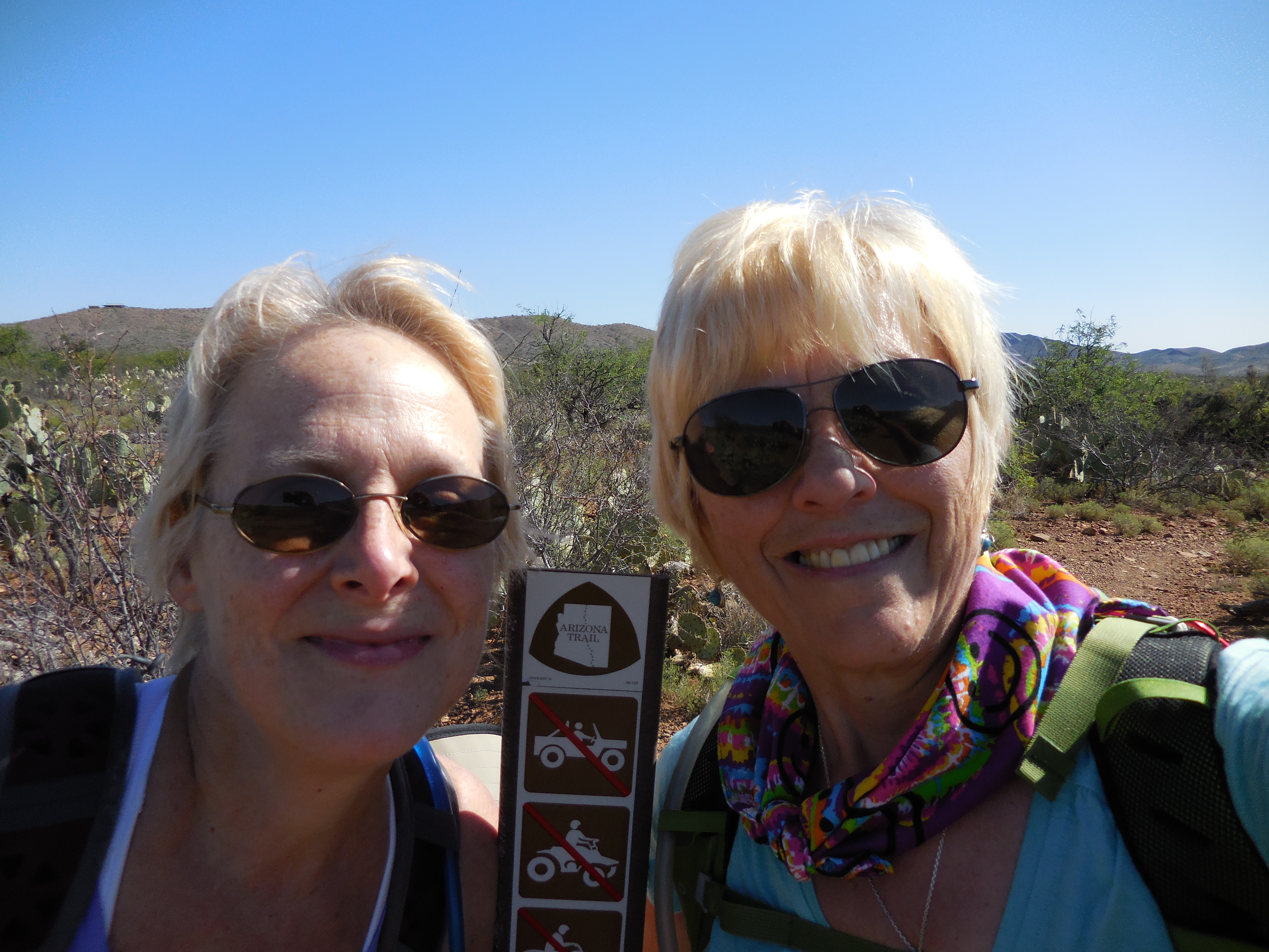
The weather was perfect, the temperature could not have been better for hiking and there was a breeze in the air. We hiked through a landscape covered with creosote bushes, gently losing elevation as we added miles to our total.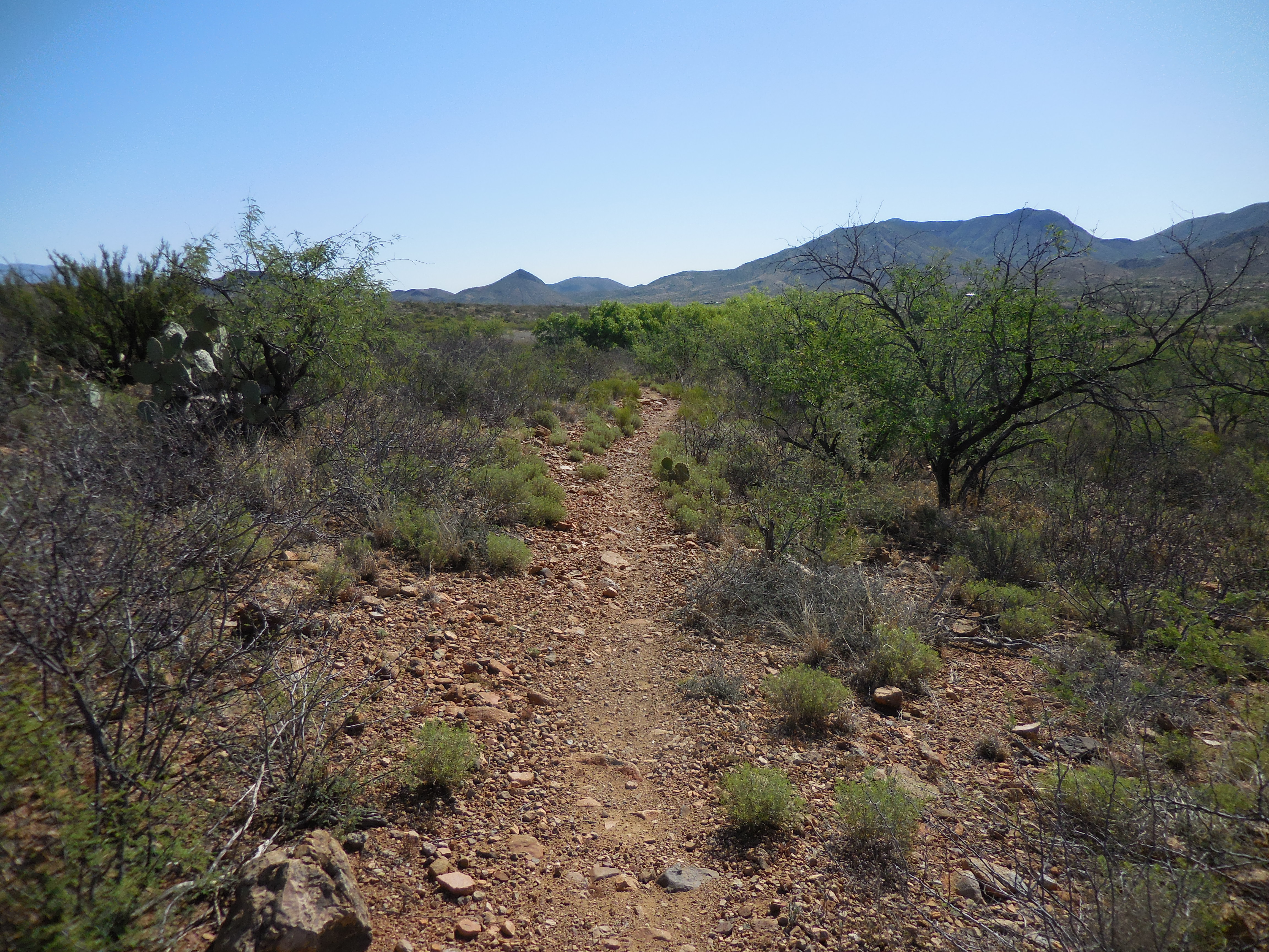
Several times we had to move off the trail to allow for mountain bikers to pass. We chatted with one of the cyclists, he was wondering how the trail was ahead of him, which was the direction from which we came. It seems he was riding while his wife and mother-in-law were hiking the trail, he was somewhat of a scout for them. We encountered this young man several times through the rest of our hike.
He told us how his mother-in-law loved to hike and was looking to find some great trails around the area. I never miss a chance to promote the APOC chapter I head up or my tour business, Choose Happiness Adventures, so I handed him my business card to give to his mother-in-law.
We hiked on. It was beautiful, each Passage on the AZT seems to show us a different desert than the desert we are familiar with. As I said earlier, this passage was covered with creosote bushes and some ocotillo and prickly pear cactus, the dirt was brown quite different from the desert in Tucson.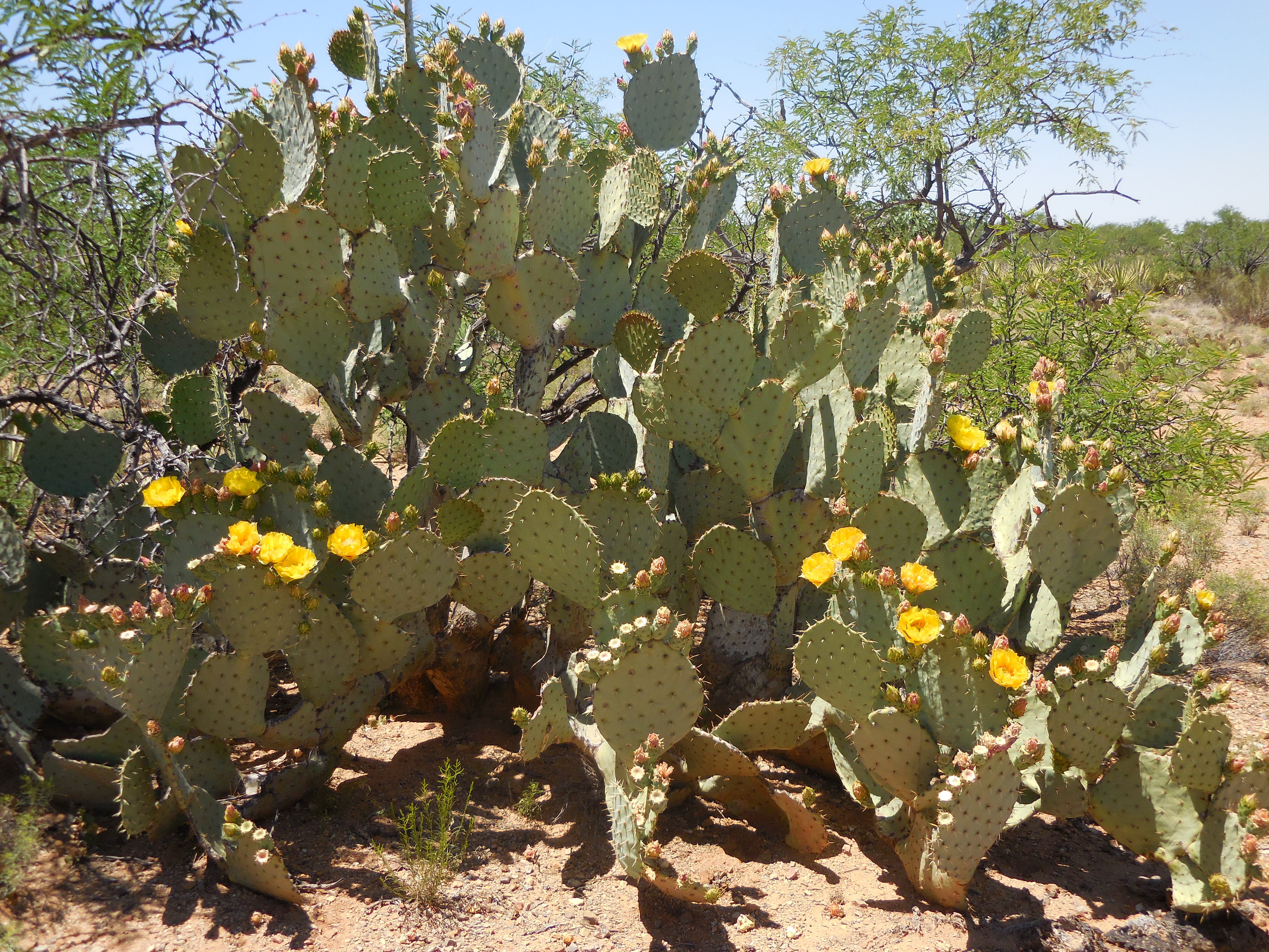
Finally we came to a culvert passing under Highway 83. We stopped, sat down, took our shoes and socks off placing our feet on the cool cement and had a snack of nuts and raisins. We rested for a while before we decided to continue onward. It appeared by what my Garmin had calculated and what the guidebook said about the trail mileage that we only had 3 or 4 more miles to the Gabe Zimmerman trailhead.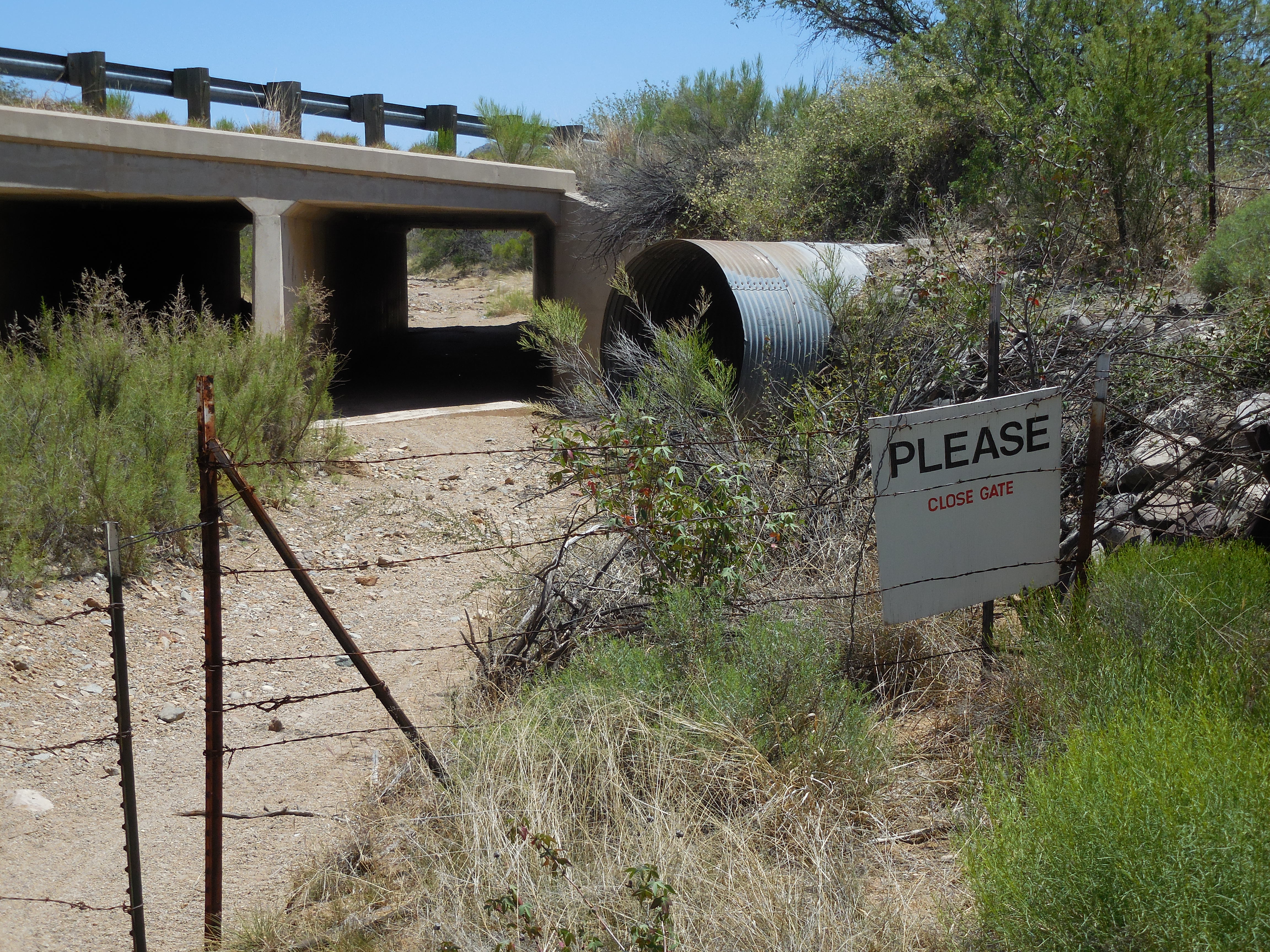


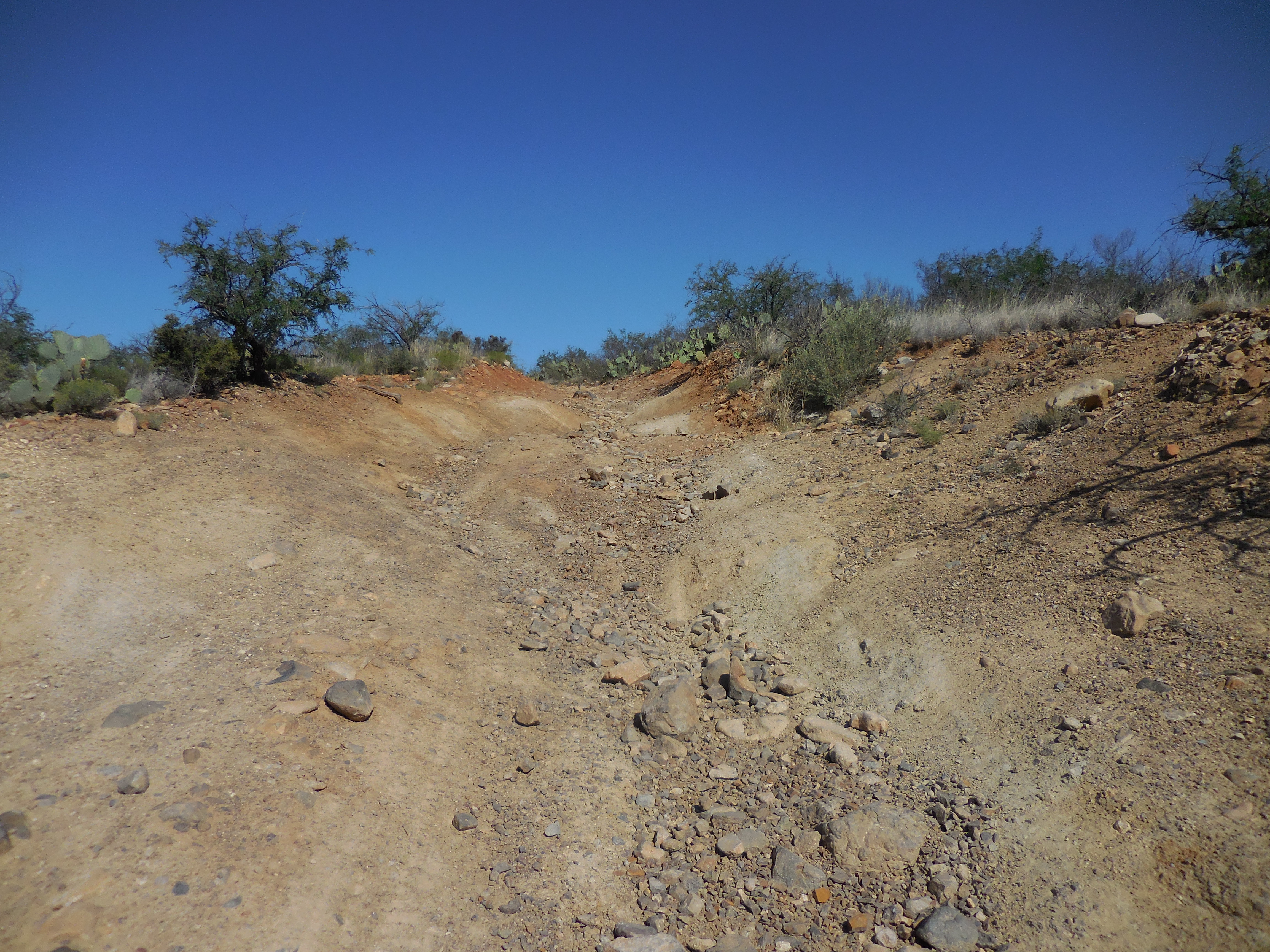
The guidebook said to “Continue in the wash, and look for a cairn marking the exit from the wash off to the right. Take this path south, paralleling, but now east of AZ 83 until the trail starts to head east.” We walked in the wash looking for the rock cairn, we walked for about 1.5 miles without seeing anything – no cairn and no trail exiting out of the wash. We turned back thinking we must have missed the cairn or trail.
Nope, we ended back at the culvert! I tried to load the GPX file for the AZT into OSMand+ but did not have any service on my phone and foolishly I had not downloaded the track to my Garmin.
We had to make a decision as we had been out hiking for almost 7 hours. We decided to walk back to the Sahuarita Road trailhead and see if we could hitchhike back to Lova’s truck.
As luck would have it, the Universe placed another trail angel in our path. As we emerged from the trail and crossed Sahuarita Road, a gentleman dressed in a white shirt and tie was walking back to his car from the trailhead on other side of the road. Lova ran calling to the man asking for help, promising him we were not looking for money to get to Phoenix or anything like that, we just needed a ride up Highway 83 to her truck. He agreed to take us to her truck.
We hopped into his vehicle and he took us to the truck. When we got out of his car we thanked him for the ride, he told us to have a good day, be safe and he drove away.
Needless to say we both were angry because we couldn’t finish the Passage, but we have plans to return next Sunday. The difference will be I now have the GPX coordinates loaded onto the Garmin as well as OSMand+ on my Smartphone and we will begin the hike heading south instead of north, so this time when we emerge into the wash we will know what direction we are headed to get to the Sahuarita Road trailhead.
Just as a post script, I did email both Trail Stewards about the problems with the Guidebook. I have received a reply directly from the Executive Director of the Arizona Trail Association thanking me for bringing the trailhead discrepancy to their attention. It will be corrected in the next edition of the book. I am still awaiting a reply from the Trail Steward responsible for the section where the alleged rock cairn and trail exiting the wash is located.


Wow, do you ever have an abundance of Angels!
I see by the countdown that there are only 13 days to go before Portugal!!
You must be getting very excited. I’m looking forward to stories of white port, the food and all the sites.
Love the pictures above
Lynda
LikeLike
Hi Lynda,
Thank heaven for Angels! Yes!
Actually the first day of the tour is 13 days from today. But I am leaving the States in 10 days to ensure everything is in place
Arlène
LikeLiked by 1 person
Sounded like you had a fun day though Arlene. Every walking day is always a different adventure isn’t it?
LikeLike
It was fun Angie, it just didn’t end the way we had planned. We ended up walking more total miles than the actual Passage.
LikeLike